Apologies if this should go elsewhere or would be better tacked on to one of the existing map threads but they looked like they were long dead so it seemed better to start a new, current topic.
I’m playing around with various mapping apps (because there’s definitely nothing more productive I could be doing) and was trying to overlay the latest site plan on Google Earth.
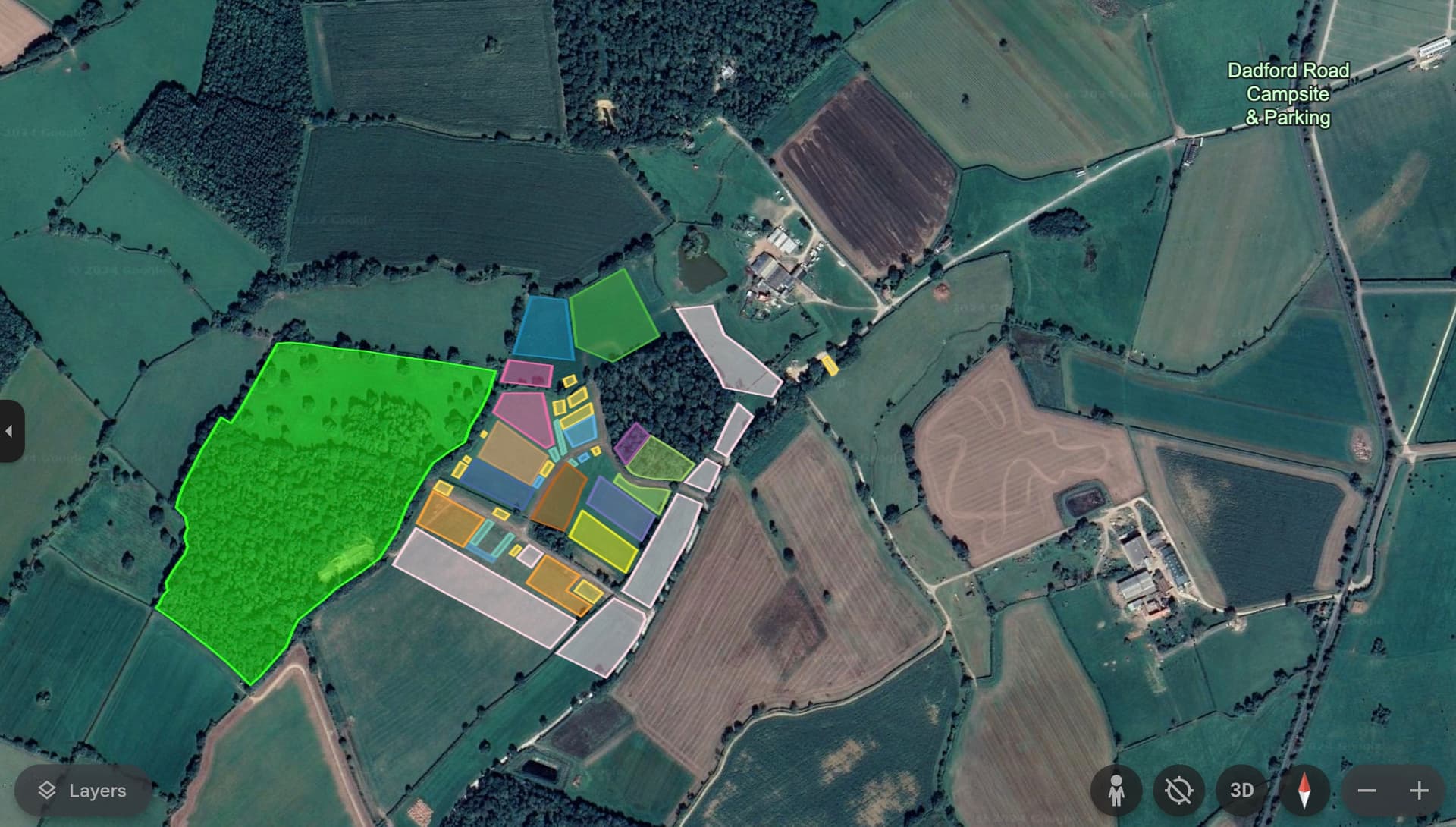
So far, I think I’m pretty close but if anyone can see glaring mistakes (or piddly little ones) it would be great to get some feedback.
The first problem I ran into was that I can’t see where the access road shown on the PD map as leading though the bottom left OC camping and out through the middle of the bottom right OC camping is in real life - there don’t seem to be any breaks in the hedges or existing tracks that match.
Can’t speak for the traders/GOD areas, as they are changing a little, but some of those polygons are a little small.
White OOC camping, NE corner, should extend around the pond, covering an arc 4 o’clock to 10 o’clock on there. Also the near corner of the field directly north of Dawn/Wintermark is being used for OOC camping, maybe 5% of that field.
Wintermark extends all the way to the hedge to the east, so butts up against the expanded OOC camping. And into the Navarri Woods about 20%.
Navarr fills those woods completely, wrapping around the Imperial Orcs and making contact with Wintermark coming up the hill.
Previously, there was a narrow field containing GOD and crew camping to the south (and slightly west) of the main IC area, with a narrow strip of OC camping in the next field to the south of that.
I’m pretty sure that to accommodate the new trader’s square there, the fence between those fields has probably been moved south substantially, so it’s roughly where the southern border of OC camping used to be.
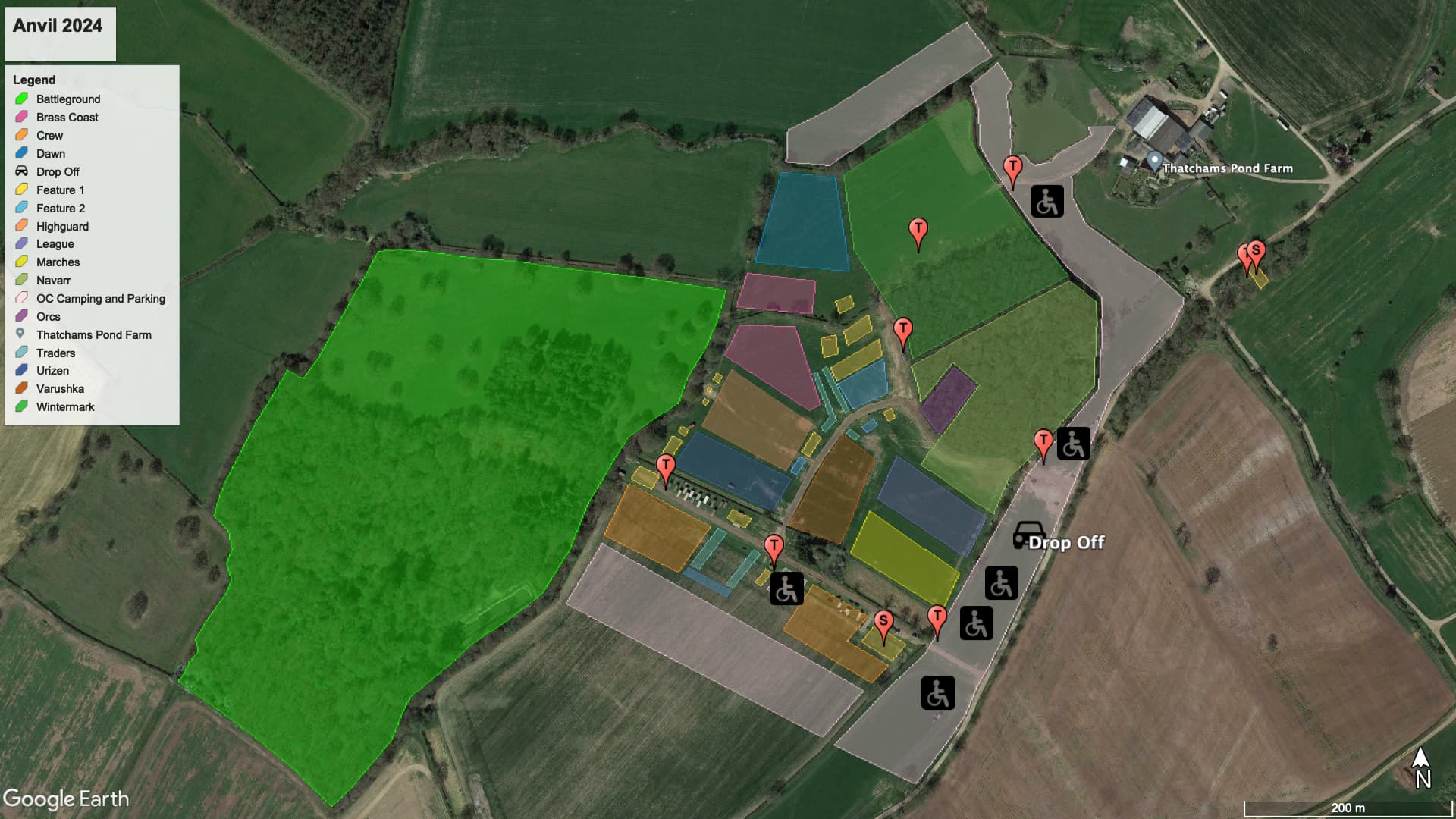
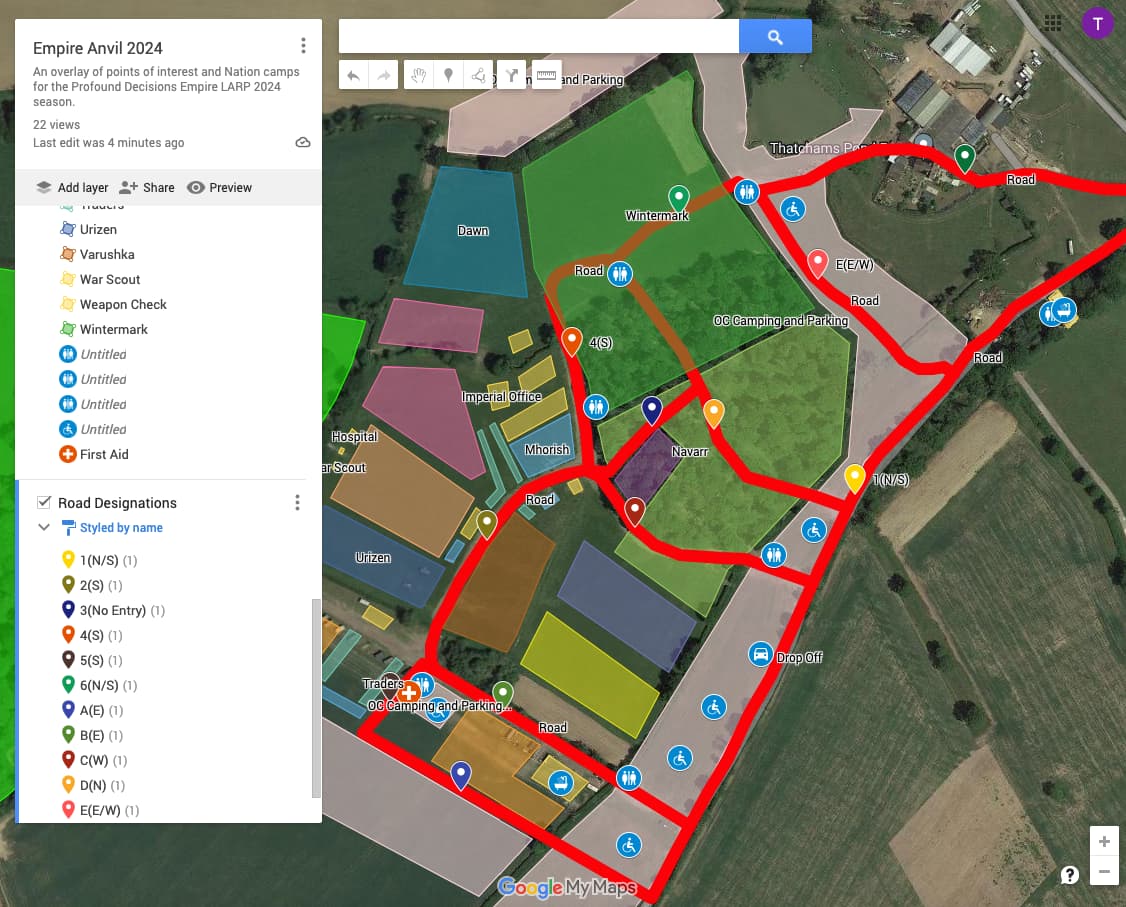
I’ve incorporated the changes suggested (as best I can interpret them) and added Toilets (T) Showers (S) and accessible camping plus the pickup point. Updated KML Map Overlay
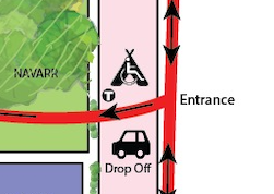
On the PD map it shows ‘Entrance’ by the Drop Off point but is that where cars actually enter the site or do they come in down the track that leads NE past the showers and toilets back to the road?
I forgot to check! I haven’t been to Empire yet, this will be my first time (supporting my 16 year old son). Is there somewhere all of this has already been set out? I’ve no desire to make work but I couldn’t find the site layout other than the fairly abstract one on the PD Event page and I’m too much of a map geek for that to scratch the itch.
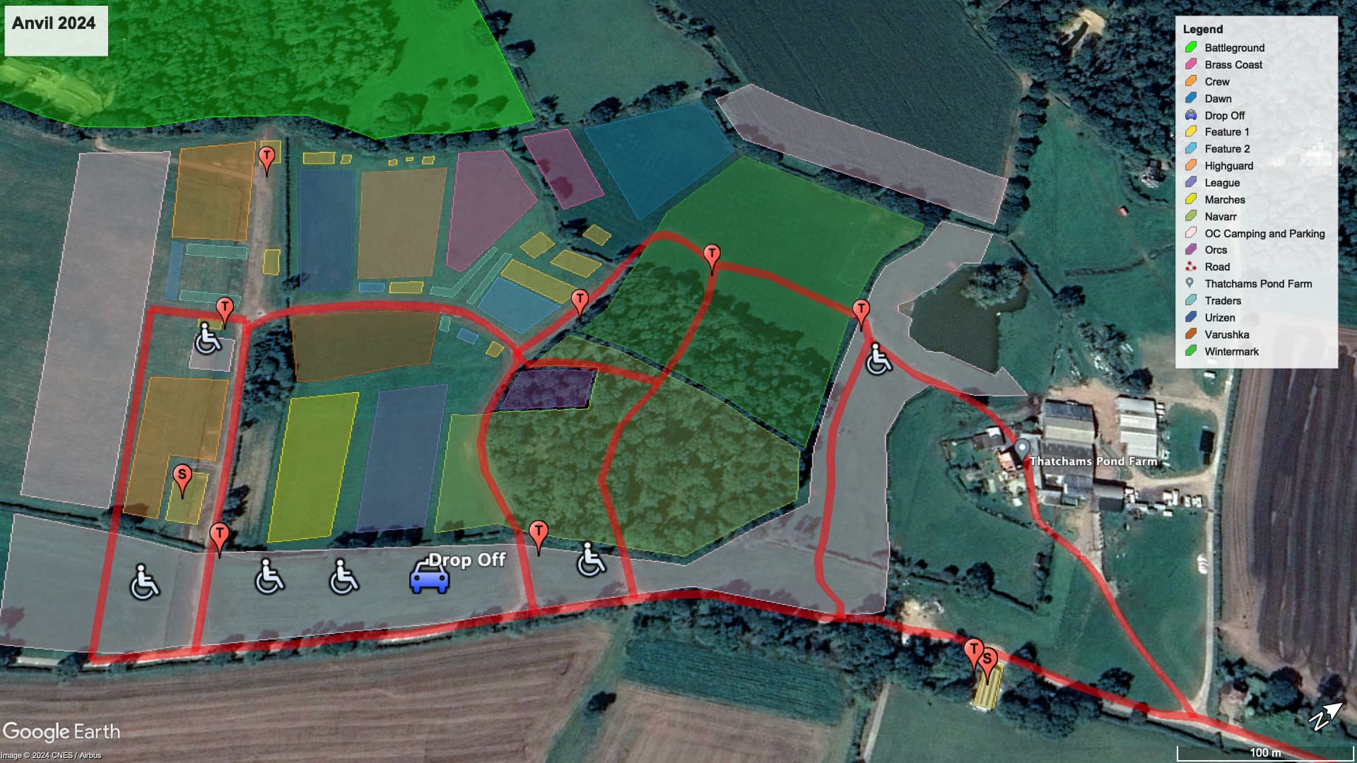
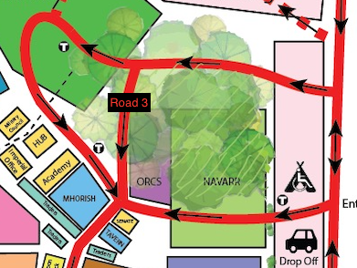
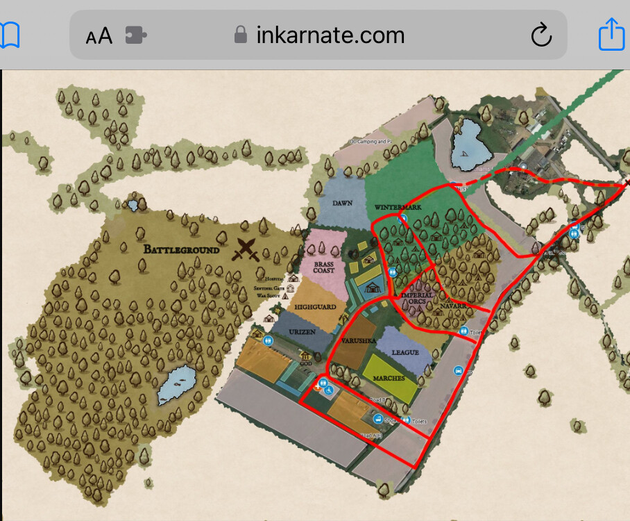
KML files won’t let me add directional paths nicely, so I’ll try to get the roads placed properly first then I’ll take them over to Inkarnate to put travel indicators on. Updated KML Overlay
Does this look correct to you? I must admit it’s hard relating the PD plan to the patches of wear on the satellite imagery. I also don’t know what the difference is on the PD plan between solid red tracks and dashed ones.
From left to right, vertical-ish roads:
A (OOC camping and Crew areas) Southbound
B (between GOD area and Marches) Southbound
C (through Navarr twixt field and wood, past Imperial Orcs) Northbound
D (Through Navarri woods into Wintermark) Northbound
E (Through OOC camping towards pond) Either way.
Horizontal-ish roads. left to right:
(GOD to OOC area) Westbound
past Varushka down to confluence with Imperial Orcs) Westbound
(From intersection with IO to center of Navarr) Non-navigable, to the best of my knowledge.
(From intersection N towards Dawn then turning into Wintermark) South-west bound.
(From woods edge of Wintermark into OOC camping to the east) Navigable either way.
(From the OOC camping area E of Wintermark, back out through the farmyard) Eastbound only, generally only during takedown of the site.
(Along the south edge. ) Eastbound from the interesctions of A and B to C, then either way the to the entrance.
The idea is that folk come in along 7, disperse onto site through C, D and E. Leave their cars etc parked near A or E during the event. Return to tents post event through C, D and E. Leave site via A/B + 7 or 6+7.
This is to ensure a steady flow of traffic on and off site with minimal blockages of traffic where vehicles are trying to get past each other.
For example, my pattern (camping in Dawn) is likely to be
7E54 (set up), move car via 21A (park for event), then A7E54 (pack tent), 21A7 (leave site).
There isn’t really a good way to add the direction signs on for roads but I can put the compass direction of travel in the name.
Road 3 shows on the PD map as southbound. I may have it located incorrectly. It looks like it separates the Orcs and either Wintermark or Navarr depending on how far around the Orcs Navarr goes.
I’ve also changed Road 6 to Road F as it travels East and renumbered the N/S roads so that the entrance road is Road 1.